Session 5: How do we know?-part 2
Task
Make a short research presentation (minimum 3 slides) which contains reference to at least one image/visual resource, one book, one source from another media (newspaper, documentary, interview etc) and relates to your project/place to date.
For my research, although I have anecdotal evidence and a few references to there being Māori living in Days Bay, I have no solid information about where they lived or what happened to them.
So, that will be my research topic:
Locating the Māori of Days Bay
The original Māori name for Days Bay was Otuamotoro.
Otuamotoro: Day’s Bay. A Ngati Ira fortified village. Built by Te Hiha six generations ago.
Bauchop, H. Ngati Ira and Rangitane in Te-Whanganui-a-Tara to 1865. A Report Commissioned by the Waitangi Tribunal, January 1997[1]https://forms.justice.govt.nz/search/Documents/WT/wt_DOC_93653064/Wai%20145%2C%20H005.pdf
So, the Ngati Ira Iwi were the original residents.
How many settlements were there?
We have evidence from interviews with Māori elders that there was more than one settlement in Days Bay. James Cowan, noted for his books on colonial history and Māori ethnography, documented a discussion on this and related subjects with a Māori woman called Rangi te Puni:
One day Rangi te Puni took me to the sandy beach-side at Pito-one to point out some of the old-time homes and fishing places of the Atiawa and their kin. “The place you call Lowry Bay,” she said, “was called by us Whio-rau, because of the abundance of the whio or blue mountain duck, in the little streams that came down from the hills about there. Ngau-matau (“Bite the Fish-hook”) is the northern point of Whio-rau. “Beyond again”—and the old dame pointed to Day’s Bay—she called it “Daisy Bay” —“we had a small settlement named Te Aewa. The north end of the Bay was Te Wharangi. The cliff there was one of our olden fishing marks. When the men went out in their canoes to draw the long seine net for moki or rock cod in the early morning, they used to paddle out in a line from the mouth of the Korokoro Creek, on the west there, across the harbour towards Te Wharangi.”
Tohunga. (October 1 1934). The Wisdom of the Māori. THE NEW ZEALAND RAILWAYS MAGAZINE, VOLUME 9, ISSUE 7
There’s also reference to a pā site:
Day’s Bay. On the ridge to the north may be seen the remains of a fortified position, as evidenced by levelled hut sites, an earthwork defence, and butts of totara posts.
The positions where even a single line of earthwork defence was employed, are but few, and consist of one at Days Bay …
Best, E. The Land of Tara and They Who Settled It. The Journal of the Polynesian Society, Vol. 28, No. 109, 1919[2]http://www.jps.auckland.ac.nz/document//Volume_28_1919/Volume_28%2C_No._109/The_Land_of_Tara_and_they_who_settled_it._Part_VI%2C_by_Elsdon_Best%2C_p_1-17/p1
Here’s another source on this:
Orua- motoro Pa was located at Days Bay and was said to have been built by Te Hiha of Ngati Kahungunu (Ngati Ira?).
Raukura Consultants. Eastern Bays Shared Path. Hutt City Council, 2018
What remains as of 2021?
Unfortunately, most of Days Bay where the kāinga and pā would have stood has been subdivided and developed.
How the pā site may have looked
A pā site like this would typically have had some kind of terracing and house platforms, surrounded by a Totara palisade. This example from the King Country shows what it could have looked like:
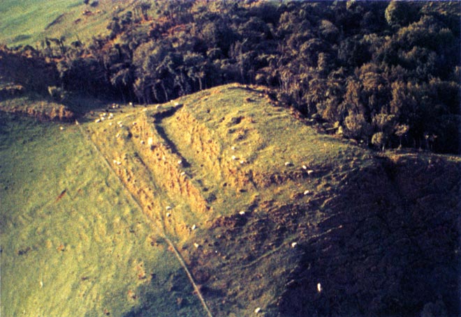
So, now we have evidence that the pā existed, and had been abandoned by 1919, given that it was seen as a ruin.
What happened to the pā after 1919?
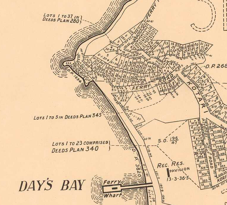
Given that the pā site was on the “ridge to the north” of Days Bay, then it would have become part of the first tranche of sections that were developed for residential housing.
This is a map of subdivisions at Day’s Bay, Lowry Bay, etc. compiled from official records by Palmer & Mahood in 1922.
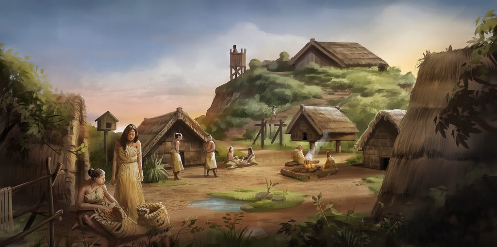
How might the Days Bay villages ave looked?
The villages themselves are likely to have comprised of wood or flax built huts, and unfortunately would not have left much archaeological evidence of their presence.