Initial idea
I want to create some kind of artwork, perhaps a painting or collage. We discussed our ideas as a group in class, and it appears that a collage is a pretty “standard” idea, but to be blunt I’m really not a fan of collages. That doesn’t make it a bad idea per se. So, where next?
Reimagining colonization?
How might Oruamatoro have looked if arriving peoples had integrated into what went before? We might see the arriving Māori build their village without clearing land; instead, their village could have been sited on the beachfront and in the trees. The arriving Pākehā could have built their own houses and other buildings alongside the existing Māori buildings; perhaps with both the newcomers and the existing residents adapting their buildings to take best advantage of the learnings from both people. Later, as modernization occurred and the wharf and roads were built, we might see the landscape gently adapted to take them in. Not a layering of one culture over the previous one, but an interweaving and intermingling.
That’s the physical dimension of this, but it’s important not to overlook the other aspects of the course. We explored how people felt about colonization. How the legal frameworks developed. How the concepts of sovereignty and ownership are important factors. How The Treaty of Waitangi is not quite the same thing as Te Tiriti o Waitangi, and so on.
Refining the idea
So, let’s look at something that’s personal to me, and how that might have been different, if the path New Zealand had followed was different.
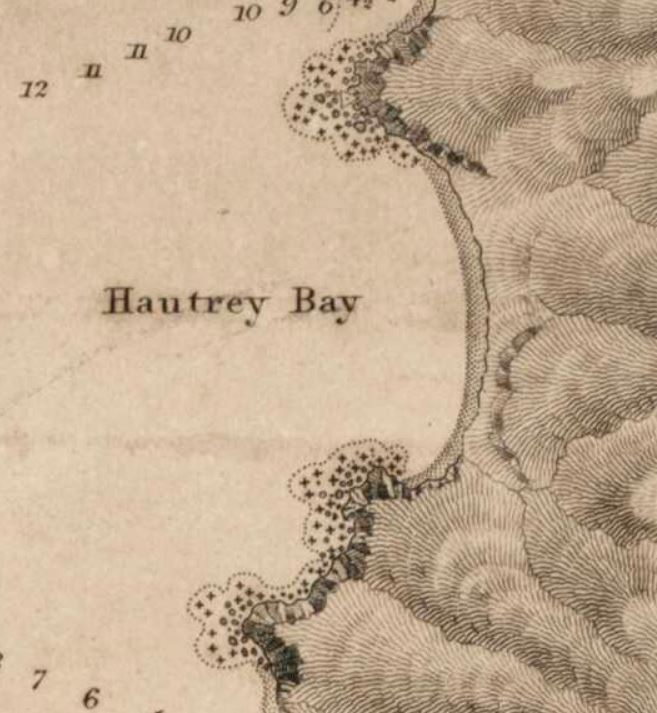
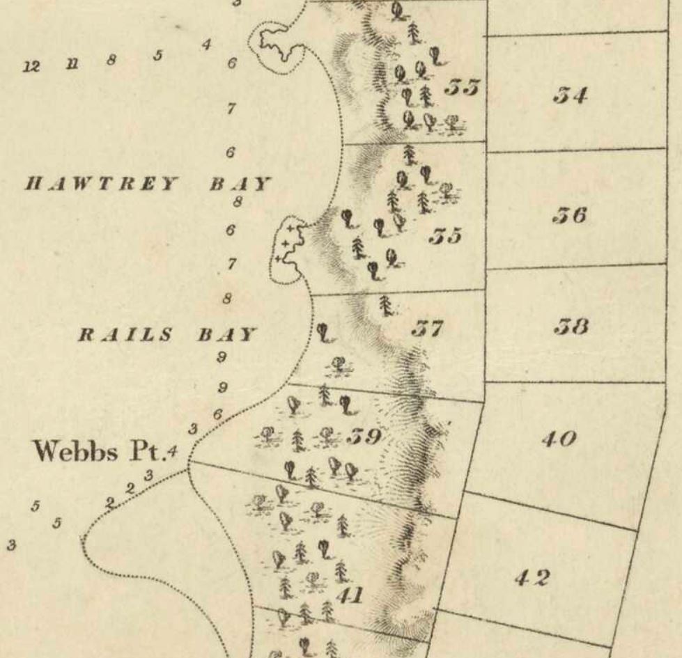
The three maps below are personal to me, because they include the section of land that I own and live on. In the first map, Days Bay was shown as a bare and empty shore, in spite (literally spite?) of the two Māori villages and pā site on the Northern headland, which the Royal Navy didn’t bother showing:
https://ndhadeliver.natlib.govt.nz/delivery/DeliveryManagerServlet?dps_pid=IE212156
The second map shows that Hawtrey Bay (now Days Bay) had become Section 33, assigned to an incoming colonist:
https://ndhadeliver.natlib.govt.nz/delivery/DeliveryManagerServlet?dps_pid=IE1271793
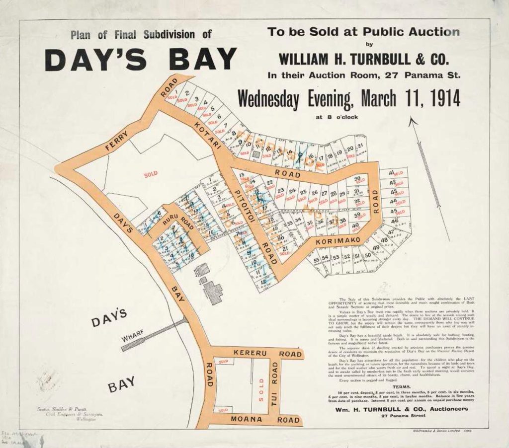
And finally, in the third map – actually an advertisement – the original section has been subdivided into the classic “quarter acre” sections dear to Kiwi hearts:
https://natlib.govt.nz/records/20911227
There’s a lot wrapped up in this final advertisement that’s worth unpicking.
Traditional Māori society did not have a concept of absolute ownership of land. Whānau (extended families) and hapū (sub-tribes) could have different rights to the same piece of land. One group may have the right to catch birds in a particular clump of trees, another to fish in the water nearby, and yet another to grow crops on the surrounding land. Exclusive boundaries were rare, and rights were constantly being renegotiated.
- This is, obviously, a map. It draws boundaries that are only really relevant to a Western mental model.
- The map shows land boundaries that originate in the original colonial plans for Port Nicholson.
- Areas of land are for sale.
- How would this have been pitched if ownership was not the default?
- What type of property arrangement would have been made, if the legal framework we’re operating under better reflected mātauranga Māori?
- Would the mechanism still have been a sale by auction?
- Could some different kind of contractual approach been used?
- Would there still have been a map? If so, what might that map have looked like? What else would have been on the map? Shared space?
- Would there have been Māori influence in the advertising?
- Would Te Reo have been used in the text?
So, my initial idea is to recreate some of the early advertising, to show what it might have looked like if the audience were people who would be integrating into Days Bay, rather than simply overlaying their culture on top of the area.
Some questions to think about…
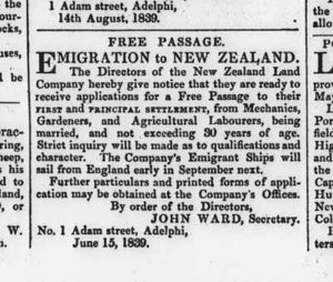
Until 1839 there were only about 2,000 immigrants in New Zealand, and perhaps 70,000 Māori; by 1852 there were about 28,000 immigrants.
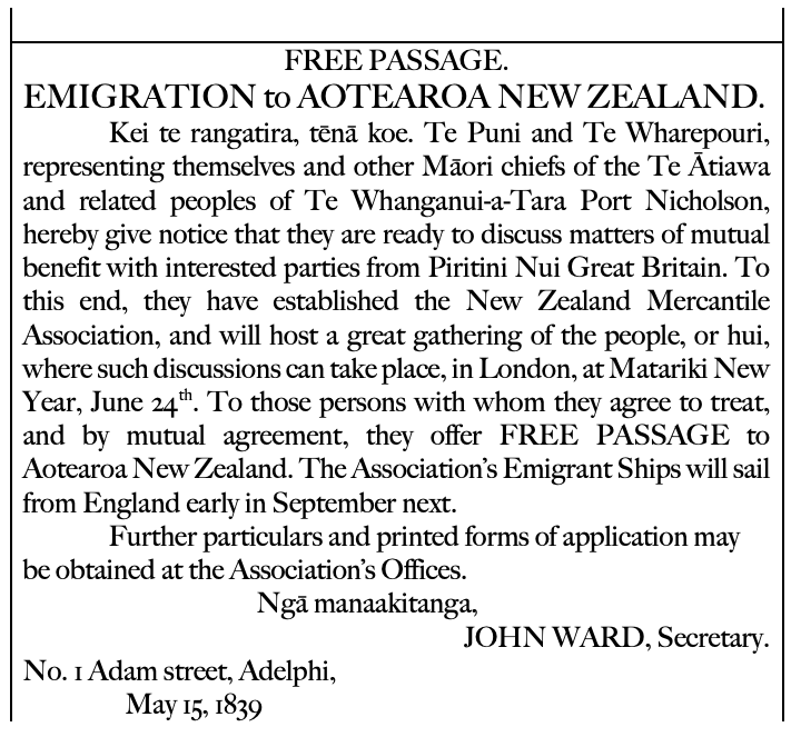
So, what would the advert have been proposing? Perhaps the local Iwi would be offering to hold a hui with interested parties, to discuss how mutually beneficial arrangements could be made, so that people moving to New Zealand would have a place to call home?
Perhaps, in the spirit of continuity and to show flexibility towards Western customs, the Iwi were willing to negotiate a term for the agreement, to allow whanau with young families to settle until the parents passed away, or until a mutually agreeable date, whichever was shorter.
Included in the agreement for an area of land for a house to be built could be rights to use the common facilities in Days Bay, for example to hunt in the hills behind the bay, or to fish in certain areas.
The local Iwi might have been looking for people who had valuable skills to bring to the community, or who were willing to invest in the community in various ways. There may be no fixed ideas about this – this could have been the start of a dialogue, and the hui could be for the people of the Iwi and the new immigrants to get to know each other and start discussing how best to live together.
Re-imagined information – Concept #1
My first experiments
Maybe look at these next?
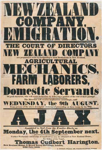
Jock Phillips, ‘History of immigration – British immigration and the New Zealand Company’, Te Ara – the Encyclopedia of New Zealand, http://www.TeAra.govt.nz/en/ephemera/2096/new-zealand-company-poster (accessed 10 May 2021) 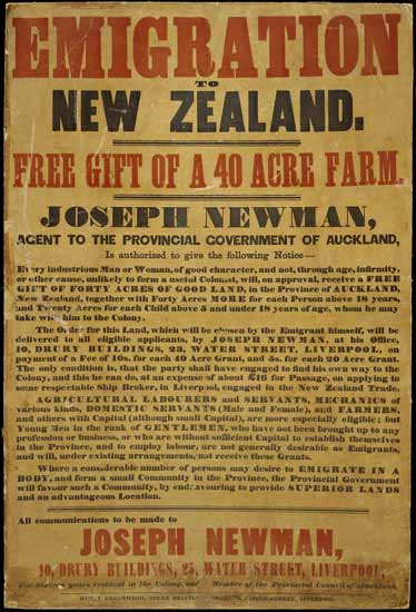
Fiona Barker, ‘New Zealand identity – The land’, Te Ara – the Encyclopedia of New Zealand, http://www.TeAra.govt.nz/en/ephemera/34600/emigration-poster (accessed 10 May 2021)
Stop! Pause for breath…
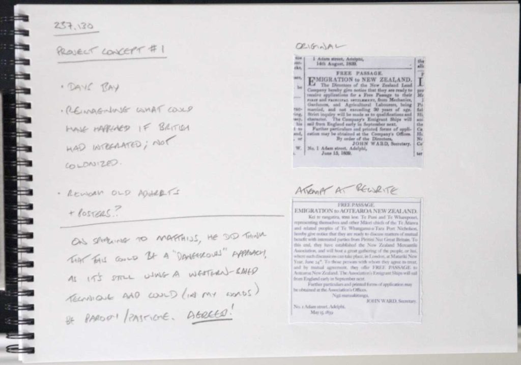
Having spoken to Matthijs, he pointed out something really obvious here: that I’m still approaching this from a Western mode of thinking. He suggested that this is a potentially dangerous road to go down.
So, I took this opportunity to speak to a Māori colleague about this (albeit briefly), and yes, I’m on a concerning track.
This feels like you’re trying to say, “if only Pākehā had understood Māori tikanga, everything could have worked out differently and everyone would have lived happily ever after”. That sounds very naïve and Pollyanna, and you’re still telling the story from a Pākehā point of view.
(Quote as remembered by me – anonymous by request)
At that point, I pretty much gave up on that idea, and moved onto to think a lot more about what I wanted to achieve through this piece.
Also, I’d view it as a kind of failure if I didn’t really push myself outside my comfort zone with this.
I can default to a kind of, “yes, Māori lived here, they got displaced, let’s tell the story of that and try and relate to it”. But, is that really what I want to say about the place I live, or I am being constrained by the expectation boundaries of this course?
What do I really want to do?
What am I trying to get across? I want to show that:
- I understand (probably more than quite a lot of local Kiwis) something of the history of Oruamatoro/Days Bay;
- I acknowledge that my understanding of pre-colonial history is pretty weak;
- I feel like I’m missing out on connecting to a really important part of New Zealand heritage;
- my section is an interestingly off triangle shape;
- I have a strong connection to the three countries in which I’ve lived;
- incompleteness in my reconciliation of my place in New Zealand, and that I am essentially still living as a European; and
- finally, there’s a sense of imbalance in my understanding.
I do want to show that I’ve got a new understanding of Days Bay, and that it has affected my understanding of where I’m living. But, there’s more to it than that. I also want to reflect my long time and history living in the UK and the baggage that brings, and I want to do the same for my time in Japan.
I have reconciled my experiences with those two countries, and I have yet to reconcile my life in New Zealand. I want to show that. That, I guess, is that imbalance I’m feeling.
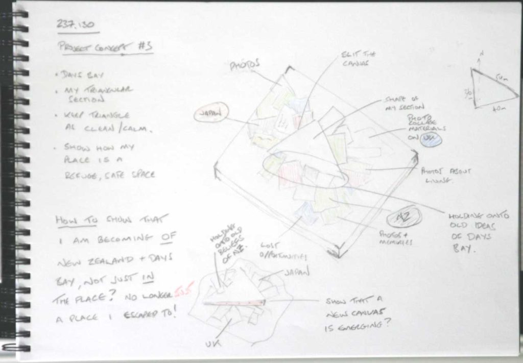
More refinement – Concept #2
Next, thought though how I might use the triangle idea as a kind of scaffolding on which to show my knowledge, and lack of knowledge, and the unbalanced/unfinished feeling that I have.
I came up with another concept, which was to build a canvas on a triangular stretcher, but leaving the canvas edges raw. Then, collage onto it some of the information that I’ve gathered during the “explore” phase of the project and some more things about my memories of the UK and Japan for contrast:
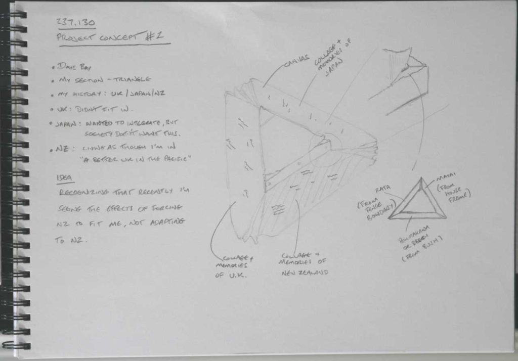
This felt kind of interesting, but I don’t need the UK/Japan things on it to make my point. It felt like this should be about New Zealand, and my pre- and post-colonial understanding.
I also had the idea of laminating native wood and imported wood together to make a strong framework, but this felt a bit forced somehow. I didn’t let it go though – love my woodworking too much!
I didn’t feel that this concept showed enough of that unbalanced/unfinished feeling, so I kept thinking about it rather than jump straight into making it.
Concept #3
The next concept was to use a regular canvas as a kind of foundation, but to have another partially formed canvas emerging from it.
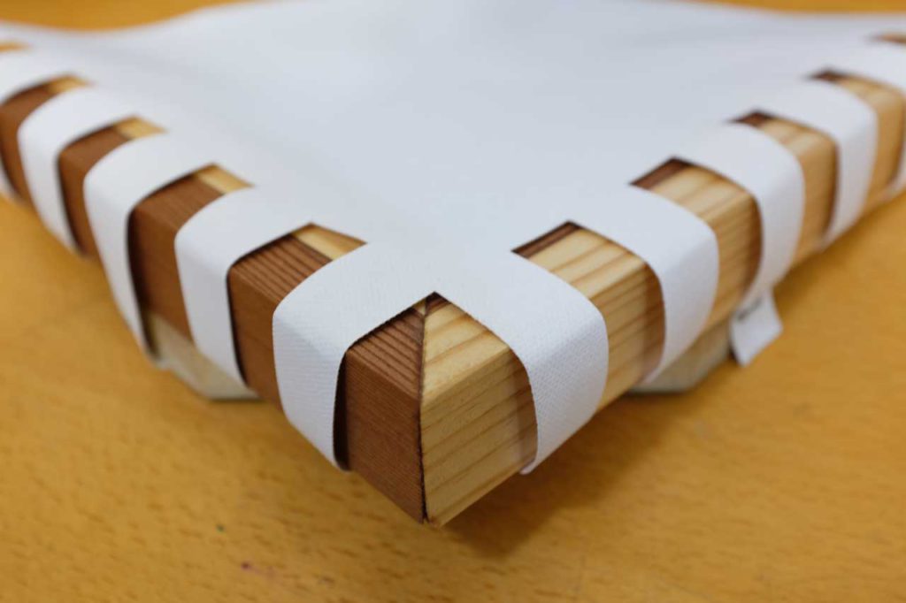
A kind of unformed, unfinished canvas emerging from a mass of information. I could re-use an old canvas for the main one, and I could have used a similar premade canvas for the emerging one, but I would have had to cut it up anyway, so I thought I may as well build a stretcher and put raw canvas on it myself. I had the idea of using a native and non-native timber for the framing, to show a kind of laminated, stretch-in-unity idea, but that started to feel a bit too forced.
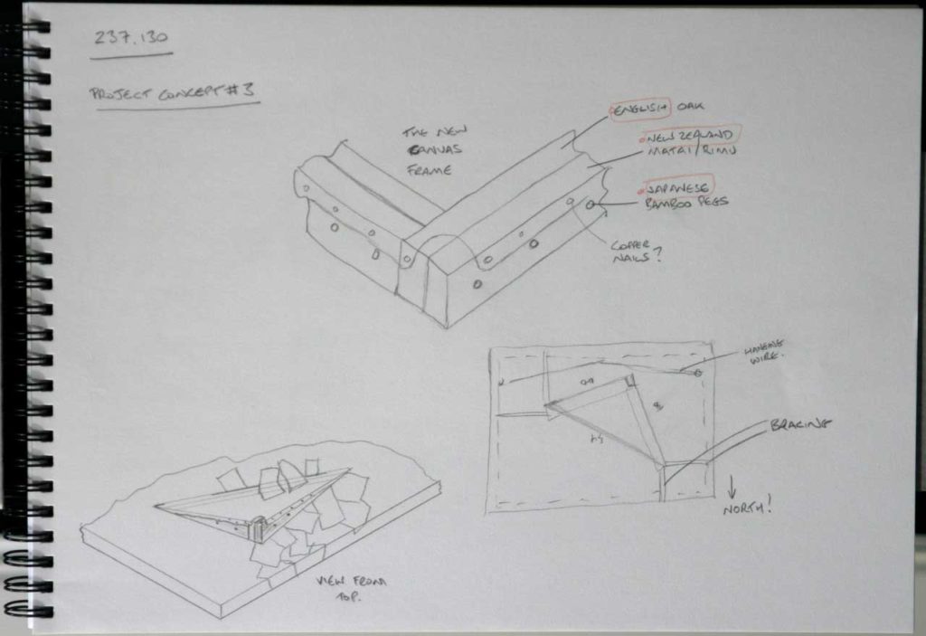
Before I abandoned the idea, I did actually go ahead and build the wooden frame using native matai timber (from an offcut of old weatherboard) and some plain pine, with a raw canvas covering. On completion though it just feel too busy and fussy for what I was trying to achieve, so it went unused. It will no doubt get reused for another project.
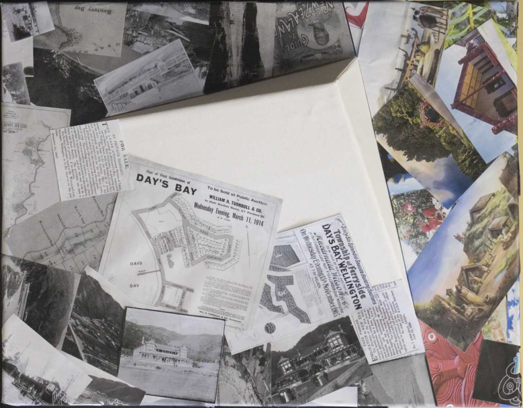
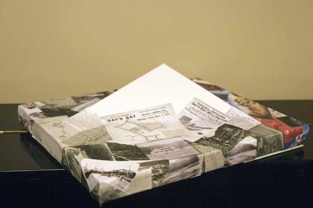
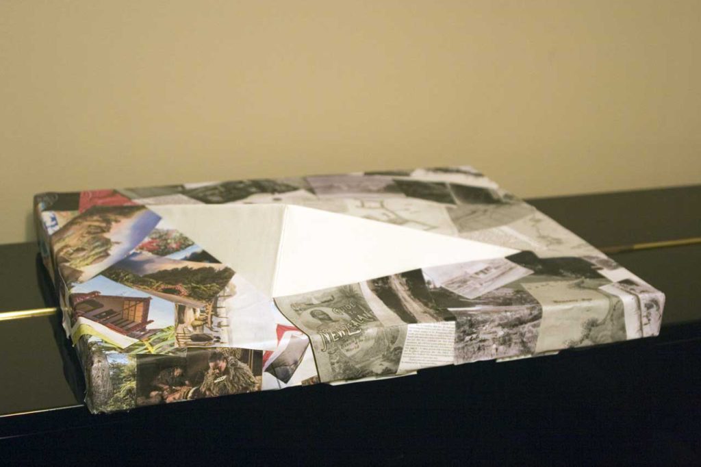
So, having given up on the wooden frame, I realised that I could get a better, and lighter weight, effect if I built the emerging canvas from corflute. Rather than stick to my original idea of the frame being a canvas, I made the emerging triangle bigger and little more dramatic. It still adhered to my original concept though, as the foundation canvas was unchanged and still had the hole in it the exact same shape as my section.
The completed piece
When I started to assemble the piece, I realised that a lot of the photos and articles that I’d collected of colonial history dated from the 19th and early 20th century, so were in mainly black and white. The images of Māori life were in the main more recent photos and illustrations. This gave me an idea: I could use only black and white items to represent my knowledge of colonial history, and use colour to show the gap in my understanding of mātauranga Māori.
So, I rearranged my items and then fit them to the shape of the underlying composite canvas, giving the result below.